Naar inhoud springen

Bestand:1884 Sanborn Fire Insurance Map - St. Raphael's Cathedral property - Dubuque, Iowa.jpg

Pagina-inhoud wordt niet ondersteund in andere talen.
Uit Wikivoyage

Oorspronkelijk bestand(2.608 × 3.834 pixels, bestandsgrootte: 1,56 MB, MIME-type: image/jpeg)

Beschrijving

Beschrijving
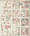
English: An 1884 Sanborn Fire Insurance Map cropped to show the property of St. Raphael's Cathedral in Dubuque, Iowa, United States. The cathedral is in the center (pink, tower in blue). The rectory is located immediately to the north of the cathedral and another dwelling, no longer extant, is shown above it. The convent, no longer extant, is below the cathedral on the location of the future parish school. The boy's school, no longer extant, and the girl's school building, which became the convent, are located behind the cathedral. Emmet Street, which does not exist at this date, was built in front of the girl's school building (future convent). The dwellings at the bottom of the block are listed as shanties and could possibly be some of the residences along Emmet Street now. There continue to be dwellings at the top left corner of the property today.
Title
InfoField
Sanborn Fire Insurance Map from Dubuque, Dubuque County, Iowa.
Shelf ID
InfoField
https://www.loc.gov/item/sanborn02633_001/
Parent
InfoField
https://www.loc.gov/resource/g4154dm.g026331884/
Sheet title
InfoField
Image 12 of Sanborn Fire Insurance Map from Dubuque, Dubuque County, Iowa.
Datum
Bron File:Sanborn Fire Insurance Map from Dubuque, Dubuque County, Iowa. LOC sanborn02633 001-12.jpg
Auteur OnbekendUnknown author
Toestemming
(Hergebruik van dit bestand)
Dit bestand is beschikbaar in de Geography & Map Division van de Library of Congress
via digitaal ID g4154dm.g026331884.
Deze banner zegt niets over de auteursrechten die van toepassing zijn. Een normale auteursrechten-tag is nodig. Zie Commons:Licensing voor meer informatie.

العربية  беларуская (тарашкевіца)  বাংলা  čeština  Deutsch  English  español  فارسی  suomi  français  galego  עברית  magyar  Bahasa Indonesia  italiano  日本語  lietuvių  македонски  മലയാളം  Nederlands  polski  português  português do Brasil  română  русский  sicilianu  slovenčina  slovenščina  Türkçe  українська  中文  中文(简体)  中文(繁體)  +/−

Andere versies
Location
InfoField
Iowa · Dubuque · Dubuque County
Part of
InfoField
American Memory · Sanborn Maps · Geography And Maps Division · Sanborn Fire Insurance Maps
Cameralocatie42° 29′ 41,18″ NB, 90° 40′ 02,52″ WL Kartographer map based on OpenStreetMap.Deze en andere afbeeldingen in: OpenStreetMapinfo

Licentie

Het tweedimensionale kunstwerk afgebeeld op deze afbeelding valt in het publiek domein omdat:
Public domain

Dit werk bevindt zich in het publiek domein in landen en gebieden waar de auteursrechttermijn het leven van de auteur plus 100 jaar of minder is.


Dit werk bevindt zich in het publiek domein in de Verenigde Staten omdat het gepubliceerd werd (of geregistreerd bij de U.S. Copyright Office) voor 1 januari 1929.

Reproducties van het werk kunnen ook worden beschouwd als publiek domein omdat ze geen oorspronkelijk karakter hebben. Dit geldt voor reproducties gemaakt in de Verenigde Staten (zie Bridgeman Art Library v. Corel Corp.), Duitsland en veel andere landen.

Bijschriften

Beschrijf in één regel wat dit bestand voorstelt
1884 Sanborn Fire Insurance Map of St. Raphael's Cathedral property in Dubuque, Iowa

Items getoond in dit bestand

beeldt af

42°29'41.179"N, 90°40'2.521"W

image/jpeg

0af4d10a7050d0cb64d0d900e91174626474fe3d

1.638.595 byte

3.834 pixel

2.608 pixel

Bestandsgeschiedenis

Klik op een datum/tijd om het bestand te zien zoals het destijds was.

Datum/tijdMiniatuurAfmetingenGebruikerOpmerking
huidige versie2 aug 2020 16:34Miniatuurafbeelding voor de versie van 2 aug 2020 16:342.608 × 3.834 (1,56 MB)FarragutfulUploaded own work with UploadWizard

Geen enkele pagina gebruikt dit bestand.

Globaal bestandsgebruik

De volgende andere wiki's gebruiken dit bestand:

Metadata