
Bestand:British Columbia-map.png
Geen hogere resolutie beschikbaar.
British_Columbia-map.png (280 × 230 pixels, bestandsgrootte: 14 kB, MIME-type: image/png)
Dit is een bestand van Wikimedia Commons. Onderstaande beschrijving komt van de beschrijving van het bestand daar.
Commons is een vrij-gelicenceerde database voor afbeeldingen, geluid, video en andere bestanden. |

|
Bestand:British Columbia, Canada.svg is een vectorversie van dit bestand. Indien niet van slechtere kwaliteit dient deze gebruikt te worden in plaats van deze rasterafbeelding.
File:British Columbia-map.png → File:British Columbia, Canada.svg
Zie Help:SVG voor meer informatie. |
 |
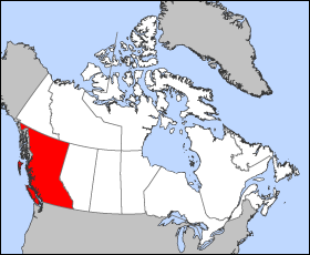
Map of British Columbia
Projection: Lambert azimuthal equal-area
Geospatial data from: The Atlas of Canada, The National Atlas of the United States archief kopie op de Wayback Machine and U.S. Geological Survey
Cartographer: John Fowler
| Ik, de auteursrechthebbende van dit werk, geef dit werk vrij in het publieke domein. Dit is wereldwijd van toepassing. In sommige landen is dit wettelijk niet mogelijk; in die gevallen geldt: Ik sta iedereen toe dit werk voor eender welk doel te gebruiken, zonder enige voorwaarden, tenzij zulke voorwaarden door de wet worden voorgeschreven. |
Bestandsgeschiedenis
Klik op een datum/tijd om het bestand te zien zoals het destijds was.
| Datum/tijd | Miniatuur | Afmetingen | Gebruiker | Opmerking | |
|---|---|---|---|---|---|
| huidige versie | 24 mrt 2005 14:12 | | 280 × 230 (14 kB) | Voyager | Map of British Columbia Projection: Lambert azimuthal equal-area Geospatial data from: [http://atlas.gc.ca/ The Atlas of Canada], [http://www.nationalatlas.gov/ The National Atlas of the United States] and [http://www.usgs.gov U.S. Geological Survey] C |
Bestandsgebruik
Geen enkele pagina gebruikt dit bestand.
Globaal bestandsgebruik
De volgende andere wiki's gebruiken dit bestand:
- Gebruikt op fr.wikipedia.org
- Gebruikt op he.wikivoyage.org